Patrick and I chose the hottest week of the year so far to stay at Esme’s caravan in Walberswick.
I spent the first few days on my own to check the workings
of the caravan. It is old and showing signs of wear and tear, but the absence
of curtains in large south facing window was a real irritation. Bryony saved
the day by bringing our large picnic table cloth, which we were able to pin
over the window for shade. That turned out to be vital given the weather.
I claim that it was all the fault of COVID 19 that I am now
over weight and unfit. I used these first few days to identify how unfit I was.
The answer turned out to be “very”. The walking of the shingle beach from the
camp site to the Blythe estuary was a nightmare.
In previous years, I would get up early and walk for an hour or so before considering the activity for the day. This was based on a circular walk up the river path and over the heathland that surrounds Walberswick.
 |
| Morning Walk |
This took rather longer than I had expected. The wooden
benches helpfully provided at various points on the way were welcome rest
stations. After my first attempt, there wasn’t a great deal of the activity for
rest of the day. In mitigation the weather was very hot.
Visiting Southwold is an essential part of the holiday.
Sadly, the delicatessen that used to be our primary port of call has now
closed. I suspect a COVID casualty. Nevertheless, a look into the Mumfords
hardware shop is always worthwhile. My route (see below) takes me through the
Southwold Golf Club.
 |
| Southwold via the Golf Course |
It appears, from the warning sign, that the golfers enjoy taking pot shots at passing walkers.
 |
| Golfers at Southwold |
As expected Mumfords provided some of the essentials for a comfortable holiday. In this case, coat hooks were missing in the caravan.
These are essential for keeping the improvised waste bin of the ground.The return journey from Southwold was via the Ferry. I met
up with Dani, the ferry owner, for the first time in a several years. She rows
the river even when it is flowing strongly. The ferry has been in her family
for several years and started helping her father aged 13. Three and a half
decades later she maintains the tradition.
The joy of the ferry is that, in this direction, it is a
short amble to the Bell. I timed my arrival for just after 11 am, where I
ordered a bitter shandy. (MS spell checker doesn’t like “shandy” – must be
American.)
By Wednesday, I felt fit enough to tackle a longer walk. The essential walking poles in hand, I set out for a walk that was going to be twice as long as I had previously tackled this week.
This stock picture shows the walking poles in action. Sadly,
I am not likely to get that high in the mountains with or without a rucksack.
However, I envy the chest straps for their rucksacks.
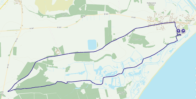
This route – as shown on the map below - is not new to me.
Indeed, Bryony and I walked it quite happily some 10 years ago. Poor fitness
and loss of balance has made this trek quite a challenge.
 |
| Extended walk via the Walberswick reed beds |
The three quarters of a mile as far as the mill in the reeds was easy.
 |
| The mill in the reeds |
The reed bed with its narrow and mostly invisible terrain
went on for about 2 miles. It took as many hours to get through it. There were
copses of flowering trees and bushes. These were pretty and I took photos, to
give myself some respite from the slow walking.
 |
| This last pic is probably a Bog Pimpernel. |
If anyone can identify these, I would love to know. (I am no
botanist.)
Gradually, the path rises out of the reed bed. Mostly, it is
built on raised wooden pathways. My walking speed improved dramatically, but I
still had to careful not lose the ferules for the poles between the planking.
It took just over 3 hours to reach the half way point, where the route almost turns back on itself. Fortunately, the state of the path for the return journey is much easier.
 |
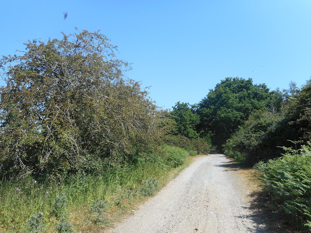
| An easier return journey |
The final obstacle was climbing the rather steep and deeply
rutted track. Thereafter, I was on tarmacked road until reaching the Tuck Shop
in Walberswick.


Comments
Post a Comment